Autonomous vehicle raises seismic survey efficiency
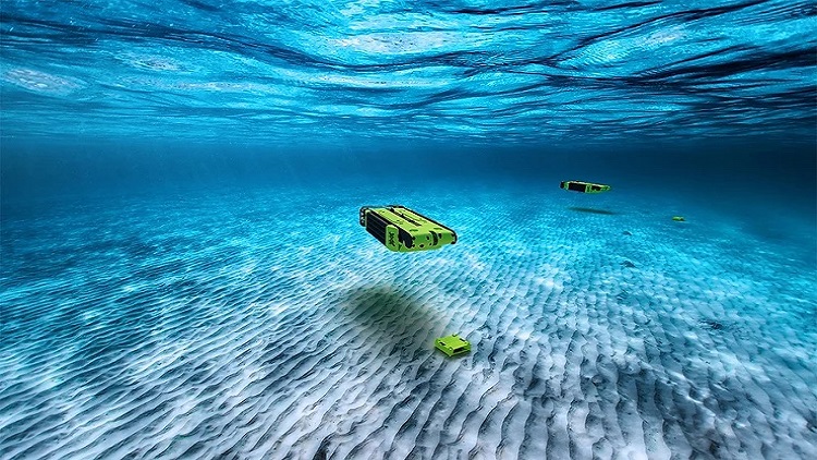
S. Himmelstein | January 27, 2025Aker BP plans to elevate the efficiency of Norwegian continental shelf exploration and development with the aid of a hovering autonomous underwater vehicle. A partnership with technology developer PXGEO will enable Aker BP to deploy the MantaRay platform to recover ocean bottom nodes with minimal impact on the ocean floor.
Traditionally, acquiring ocean bottom node seismic data has been a lengthy and costly process, primarily utilized for development initiatives and 4D seismic assessments. This new seismic acquisition technology offers scope to reduce a seismic survey operation time significantly. Aker BP said MantaRay will capture more detailed and accurate images of the subsurface, reduce operational risks and environmental footprint, and optimize its exploration and development activities in the target continental shelf area.
 Source: PXGEO
The untethered autonomous vehicle is capable of operating in water depths ranging from 4 m to 3,000 m and traveling at a speed up to 5 knots. MantaRay is engineered to carry and place up to 40 nodes with minimal environmental impact and reducing survey time duration by 50%. Real-time assessment of the node location seafloor conditions is performed using seabed classification on the vehicle’s computer using stereographic images and a downward facing sonar.