A GEM of a clean energy mapping aid
S. Himmelstein | February 23, 2023Energy developers can optimize the siting of renewable energy infrastructure in the U.S. with a dynamic mapping platform developed by U.S. Argonne National Laboratory.
Initially launched in 2013 as the Energy Zones Mapping Tool, the redesigned Geospatial Energy Mapper (GEM) is a comprehensive, interactive online mapping tool that can help identify areas across the country that are suitable for wind, solar and other renewable energy systems. An extensive catalog of mapping data includes energy resources and infrastructure, and with over 190 different mapping layers — including demographics, boundaries and utilities — users can locate areas for clean power generation, electric vehicle charging stations and other applications.
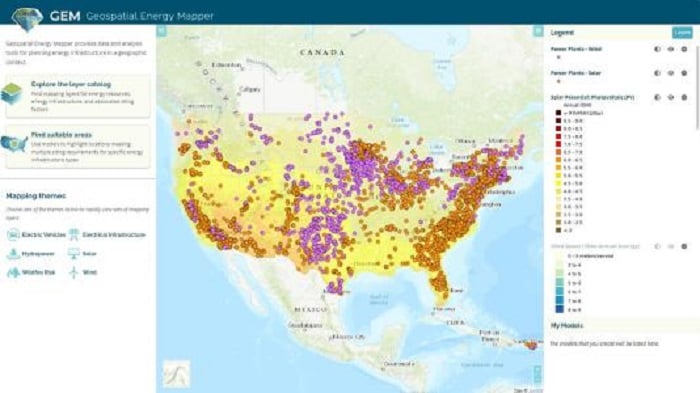 This GEM interface displays wind and solar power plant locations with photovoltaic solar potential. Source: U.S. Argonne National Laboratory
Mapping themes allow a map to focus on a specific energy technology, and the nearly 100 modeling criteria encompass site factors such as population density, proximity to nearest substation, slope, wildfire risk and low-income household percentage.
GEM is designed to benefit the development of nine types of energy resources: biomass, coal (with carbon capture and sequestration), geothermal, natural gas, nuclear, solar, storage, water and wind.