Will heavy snows in Colorado ease Arizona's thirst?
David Wagman | March 21, 2019Representatives of the seven Colorado River Basin states and key water districts formally submitted drought contingency plans (DCP) to the U.S. Congress in mid-March for implementation.
The draft agreements are intended to implement DCPs in the Upper and Lower basins of the Colorado River, which provides water to an estimated 40 million people and 5.5 million acres of agricultural land.
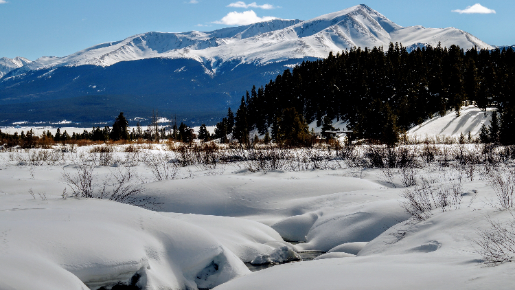 Snowpack at 10,000 feet in the Colorado Rockies. Source: David Wagman
The Upper Basin includes all or part of Colorado, New Mexico, Utah and Wyoming. The Lower Basin includes Arizona, California and Nevada. Since 2000, the region has experienced historic drought conditions. Combined storage in Lakes Powell and Mead is at the lowest level since Lake Powell began filling in the 1960s.
Snowmelt runoff into the basin in 2018 was the second lowest since 2000. Higher snowpack in 2019 is expected to ease but not end the critical water shortage for the basin, which drains more than 107,000 square miles in the Rocky Mountain and Desert Southwest regions.
The agreements that were sent to Congress for approval include a DCP for both the Upper and Lower basins.
 (Click to enlarge.) Snowpack in the Colorado River Basin in Colorado is around 200% of 2018. Source: USDA SNOTELThe Upper Basin plan (consisting of a drought response operations agreement and a demand management storage agreement) is designed to:
- Protect critical elevations at Lake Powell and help assure continued compliance with the 1922 Colorado River Compact, and
- Authorize storage of conserved water in the Upper Basin that could help establish the foundation for a demand management program that may be developed in the future.
The Lower Basin plan (consisting of a Lower Basin DCP agreement and the attached Lower Basin drought contingency operations) is designed to:
- Require Arizona, California and Nevada to contribute additional water to Lake Mead storage at predetermined elevations, and
- Create additional flexibility to incentivize additional voluntary conservation of water to be stored in Lake Mead.
In mid-March, the Bureau of Reclamation released a 24-month projection of water conditions. The report indicated improved hydrological conditions throughout the Colorado River Basin. Current snowpack in the Upper Basin was nearly 140% of average, with a forecasted inflow to Lake Powell of 92% of average for water year 2019. Water year 2019 is defined by the United States Geological Survey as Oct. 1, 2018 to Sept. 30, 2019.
“These developments may lessen the chance of shortage in 2020,” said Reclamation Lower Colorado Regional Director Terry Fulp. “However, one near- or even above-average year will not end the ongoing extended drought and does not substantially reduce the risks facing the basin.”
According to calculations done by the National Weather Service’s Colorado Basin River Forecast Center in Salt Lake City, the observed unregulated inflow into Lake Powell for February was 256,000 acre-feet. That was around 65% of average.
Unregulated inflow of runoff into Lake Powell is a critical factor in determining how much water will be released downstream into Lake Mead — which, in turn, is a primary factor in determining whether shortage conditions will be declared.
Arizona water officials warned that such a shortage declaration would prompt a first-ever shortfall in Arizona’s allocation of Colorado River water delivered through the Central Arizona Project canal system.
The forecast center also predicted that improving snowpack conditions would help inflow as well. It foresees inflow to Lake Powell of 69% in March, 80% in April and 96% in May.
Arizona water officials said that runoff totals are a function of longer-term climactic conditions, not just current weather conditions. Dry conditions in the southwestern slopes of the Rockies in 2018 created a lot of moisture-thirsty soil that soaked up a lot of the system’s runoff.
As of Jan. 7, the unregulated inflow to Lake Powell was forecast to be 6.98 million acre-feet for the 2019 water year. That outlook virtually guaranteed shortfall conditions at Lake Mead. Since then, due to favorable winter storms, that forecast inflow value has grown.
By March 4, inflow projections into Lake Powell stood at 9.751 million acre-feet, an increase of 2.771 million acre-feet.
With the improved hydrology, the Bureau of Reclamation’s February 24-Month Study raised its projection of release into Lake Mead to 8.91 million acre-feet. That was up from 8.625 million acre-feet projected in January.
The bureau’s latest forecast indicates that the April forecast is likely to show another upward adjustment, this time to 9.0 million acre-feet being released from Lake Powell into Lake Mead.
With Lake Powell roughly 40% full, it appears unlikely, Arizona officials said, that Lake Mead will see more than 9.0 million acre-feet from the upper reservoir in 2019. And that, they said, means a shortfall declaration remains probable.