Watch SWOT satellite preparations post-launch
S. Himmelstein | February 17, 2023Launched from Vandenberg Space Force Base in central California on December 16, 2022, the Surface Water and Ocean Topography (SWOT) satellite will soon begin its survey of water resources on Earth. Four cameras aboard the craft captured video of essential equipment preparations initiated immediately after liftoff, first documenting the deployment of solar panel arrays that power the mission. This process, as seen in the video above, was completed in a 10 minute window shortly after launch.
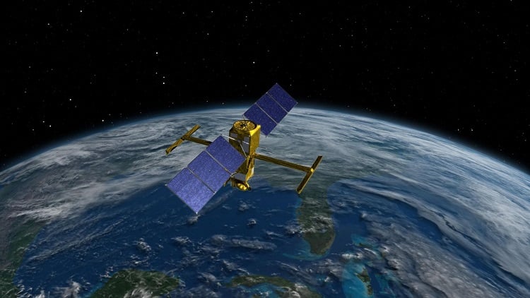 This illustration shows the SWOT spacecraft with its antenna mast and solar arrays fully deployed. Source: NASA/Jet Propulsion Laboratory-Caltech
The two antennas linked to the Ka-band Radar Interferometer (KaRIn) instrument were then extended over a four-day timeframe (see video below). Data reflecting water height and surface area will be generated by the KaRIn system, which bounces radar pulses off the water’s surface and receives the return signal with the antennas at the same time. The antennas are spaced 33 ft apart on a boom, enabling researchers to gather information along a roughly 75-mile-wide swath of Earth’s surface.
The SWOT mission will measure the height of water bodies on Earth’s surface and will document features such as eddies less than 60 miles across, smaller than those observable by previous sea level satellites. The satellite will also measure more than 95% of Earth’s lakes larger than 15 acres and rivers wider than 330 ft across.
[View another video about surveying water resources from space]
SWOT is a collaboration between NASA and the French space agency Centre National d’Études Spatiales, with contributions from the Canadian Space Agency and the U.K. Space Agency.