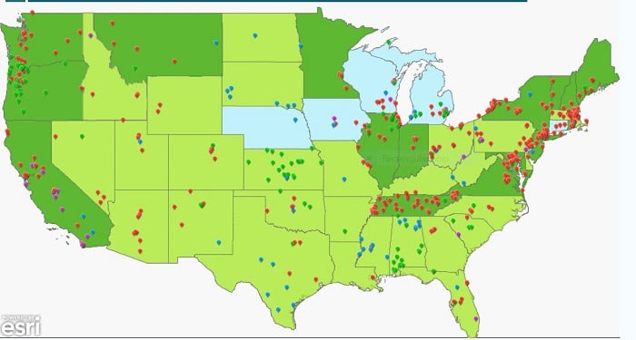
Interactive US map flags areas of water quality concern
S. Himmelstein | August 19, 2021Drinking water safety surfaced as an issue of national concern in the U.S. after the 2014 Flint, Michigan, water crisis. An interactive map has recently been updated by the National Drinking Water Alliance to highlight media reports of tap water contamination since 2015 and state actions for school tap water safety.
The tool provides users with information on state policies and programs to test for lead in school drinking water. Users can zoom in on a specific state to check for contamination incidents that were reported in the news. Red pins on the map signal lead contamination in schools and parks and link to relevant information.
 Source: National Drinking Water Alliance
The interactive map created by the Nutrition Policy Institute and Informatics and Geographic Information System at the University of California Agriculture and Natural Resources only includes tap water contamination with lead and contaminants regulated by the U.S. Environmental Protection Agency.