Breakthrough visualization tool to revolutionize the construction industry
Engineering360 News Desk | June 30, 2021BuildCentral has announced Geospex, a planned construction visualization tool built for real estate, finance and construction industry professionals. The tool provides a new way to evaluate key markets for growth opportunities and potential risks.
Using ESRI geospatial technology, Geospex pairs planned real estate development data from BuildCentral with intelligent data layers to deliver comprehensive market-specific insights without having to comb through multiple tools and tabs. Intelligent data layers include parcel ownership data, nearby opportunity zones, U.S. Census data, MSA and zip code boundaries, real-time weather warnings, demographics, drive times and more.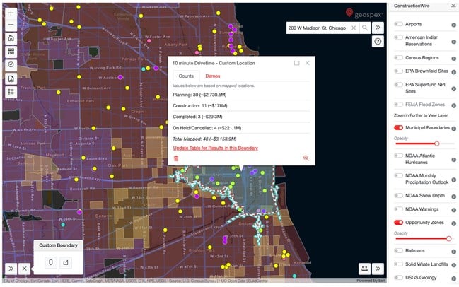 Geospex™ Planned Construction Visualization Source: Geospex
Geospex enables professionals to visualize planned commercial and residential developments parsed by Census Region, MSA, State, County or Zip Code. They can also use it to analyze any U.S. real estate market and see data layers for parcel ownership information, opportunity zones, demographics, crime rates, flood zones, weather warnings and more. The tool can refine any search by drive time or radius, measure distances between two points and the area of any custom drawn polygon and import user sales territories, distribution facilities, dealer locations, etc.
Geospex will be available starting June 22, 2021. For more information, visit the BuildCentral site.