Liftoff for NASA's Ice-tracking Satellite
S. Himmelstein | September 15, 2018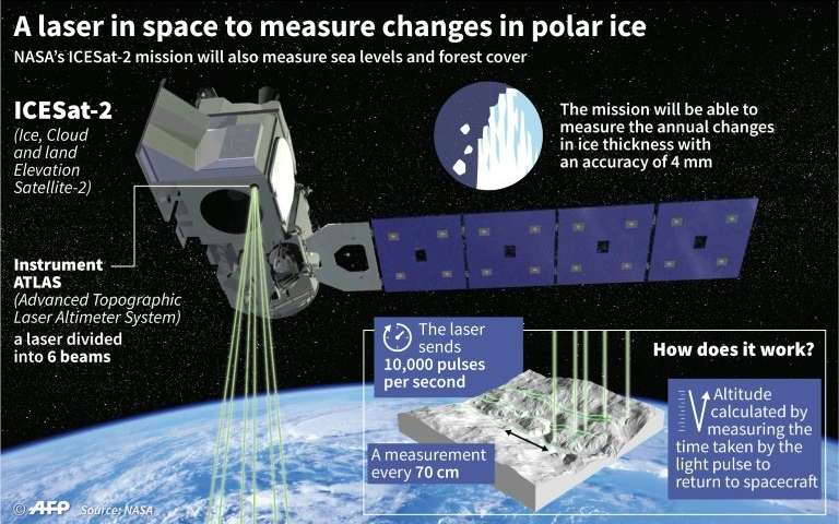 Source: NASA
The Ice, Cloud and Land Elevation Satellite-2 (ICESat-2) successfully launched from Vandenberg Air Force base in California. The satellite will use lasers and a very precise detection instrument to measure the elevation of Earth’s surface. By timing how long it takes laser beams to travel from the satellite to Earth and back, scientists can calculate the height of glaciers, sea ice, forests, lakes and the changing ice sheets of Greenland and Antarctica.
The Advanced Topographic Laser Altimeter System will fire 10,000 times in one second, generating high- United Launch Alliance Delta II rocket with the NASA ICESat-2 onboard. Source: NASA/Bill Ingallsresolution data documenting changes in the Earth’s polar ice caps and helping researchers discover mechanisms responsible for declines in floating ice. The data will also be publicly accessible through the National Snow and Ice Data Center.
ICESat-2 is now orbiting the globe, from pole to pole, at 17,069 mph from an average altitude of 290 miles.