Using drones to map Chernobyl’s radiation hot spots
Peter Brown | May 10, 2019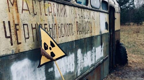 An abandoned bus in Chernobyl. Source: University of BristolAs part of the National Centre for Nuclear Robotics (NCNR), researchers from the University of Bristol carried out a series of radiation mapping surveys in Chernobyl using unmanned aerial vehicles (UAVs), revealing the existence of previously unknown radioactive hotspots.
The drones used include the first ever UAV to map both gamma and neutrons as well as the first fixed-wing UAV-based radiation mapping survey. Consequently, researchers were able to identify radioactive hotspots that were previously unknown to local authorities.
The researchers traveled to the Chernobyl exclusion zone in Ukraine, 33 years after the nuclear accident at the Ukraine power plant forced residents and workers to flee, rendering the area unlivable. The nuclear reactor was undergoing a test prior to a routine shutdown, but the core was very unstable and the result was a power surge that caused explosions that exposed the reactor core to the atmosphere.
The surveys were conducted in numerous areas around Chernobyl including Buriakivika village and Red Forest.
“This trip has provided a great training opportunity for my PhD students and is an excellent demonstration of capability for UK robotics and sensor technologies,” said Tom Scott, professor in the School of Physics at the University of Bristol.
The gamma ray spectrometry technology has previously been used at the Sellafield site in the U.K. and has been deployed numerous times in the Fukushima Prefecture in Japan.
The NCNR is funded by academia and industry and examines waste handling, cell decommissioning, underwater interventions and UAV-based site monitoring.