Chinese Satellite Data Deliver First Global Carbon Dioxide Maps
S. Himmelstein | April 20, 2018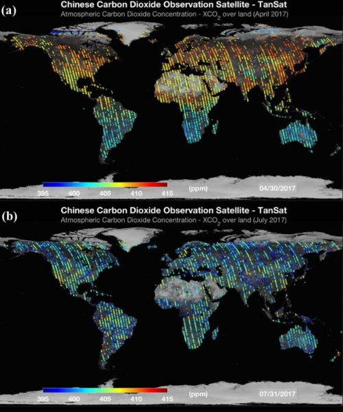 Global carbon dioxide maps produced from TanSat in (a) April and (b) July 2017. Source: Chinese Academy of SciencesData from China’s TanSat Earth observation satellite, launched in 2016, have been used to produce global carbon dioxide maps. The satellite can measure carbon dioxide's absorption in the near-infrared zone for a better picture of this greenhouse gas on and around Earth.
The data were analyzed and the maps prepared by researchers from the Chinese Academy of Sciences, who observed a seasonal decrease in carbon dioxide concentration from spring to summer in the Northern Hemisphere, ascribed to a change in the rate of photosynthesis. Emission hotspots associated with fossil fuel combustion and other anthropogenic activity are evident in eastern China, the eastern U.S. and Europe.
The researchers acknowledge some gaps in the data corresponding to the footprints of the satellite's path as it completes orbits. These can be filled by having climate satellites working in concert and traveling overlapping routes.