Expanded database now set for global solar energy planning
S. Himmelstein | May 03, 2024The high-resolution solar data available geospatial analysis tool, the Renewable Energy (RE) Data Explorer tool developed by the U.S. National Renewable Energy Laboratory (NREL) now includes data sets covering Africa, Eastern Europe and the Middle East. The geospatial analysis system can now be used to help advance power system planning and solar energy deployment in these areas as well as globally.
Data from the publicly available RE Data Explorer system can feed into tools such as the System Advisor Model, PVWatts and others that can inform ongoing and future analysis and power system planning. The updated data set was developed by compiling data sources covering Africa, Europe and the Middle East from 2005 through 2022. Imagery captured every 15 minutes by the European Union's Meteosat geostationary weather satellites was used by NREL's partners at the University of Wisconsin to model cloud cover and other relevant parameters. The agency also integrated satellite data from NASA representing aerosols to estimate the solar irradiance reaching the surface on a 4 km grid.
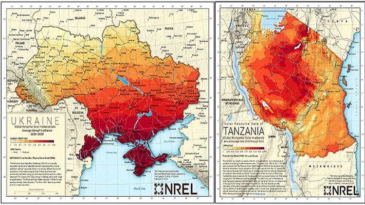 The update increases the availability of reliable, long-term renewable energy resource data for Ukraine and Tanzania. Source: Billy Roberts, NREL
Cloud properties are then processed with the Fast All-sky Radiation Model for Solar model on NREL’s high-performance supercomputer to generate a high-resolution grid over the 18-year period of the final data set.
The updated data are expected to be of particular value for energy planners in Tanzania and Ukraine, where the availability of reliable, long-term resource data is a barrier in accelerating the deployment of renewable energy.


