Optimize solar system siting with SaaS
S. Himmelstein | June 14, 2022Recognizing that a major obstacle to expanded photovoltaic system deployment is identification of suitable project sites, Norwegian startup Glint Solar has launched a software-as-a-service (SaaS) platform to help developers identify optimal locations. The approach relies on satellite imagery, government and corporate datasets, and machine learning to provide users with assessments of the risks and costs of prospective solar installations.
The SaaS system can model costs and risks for ground-based solar installations and assess project viability for a growing fleet of floating solar parks, such as solar installations sited in dams and reservoirs. The platform analyzes factors such as available solar radiation and proximity to key infrastructure, including capacity in the grid for connecting to projects. In addition to shading conditions, extreme weather trends and site elevation, social and environmental regulations are also considered. Floating solar project scoping is assisted by analysis of water depth and various underwater features that can impact project cost and performance.
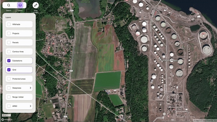 Machine learning and satellite data are used to quickly find and size viable greenfield sites for solar development. Source: Glint Solar
With this SaaS, developers now have a tool to quickly assess thousands of potential sites in early project stages.


